SPACE June 2025 (No. 691)
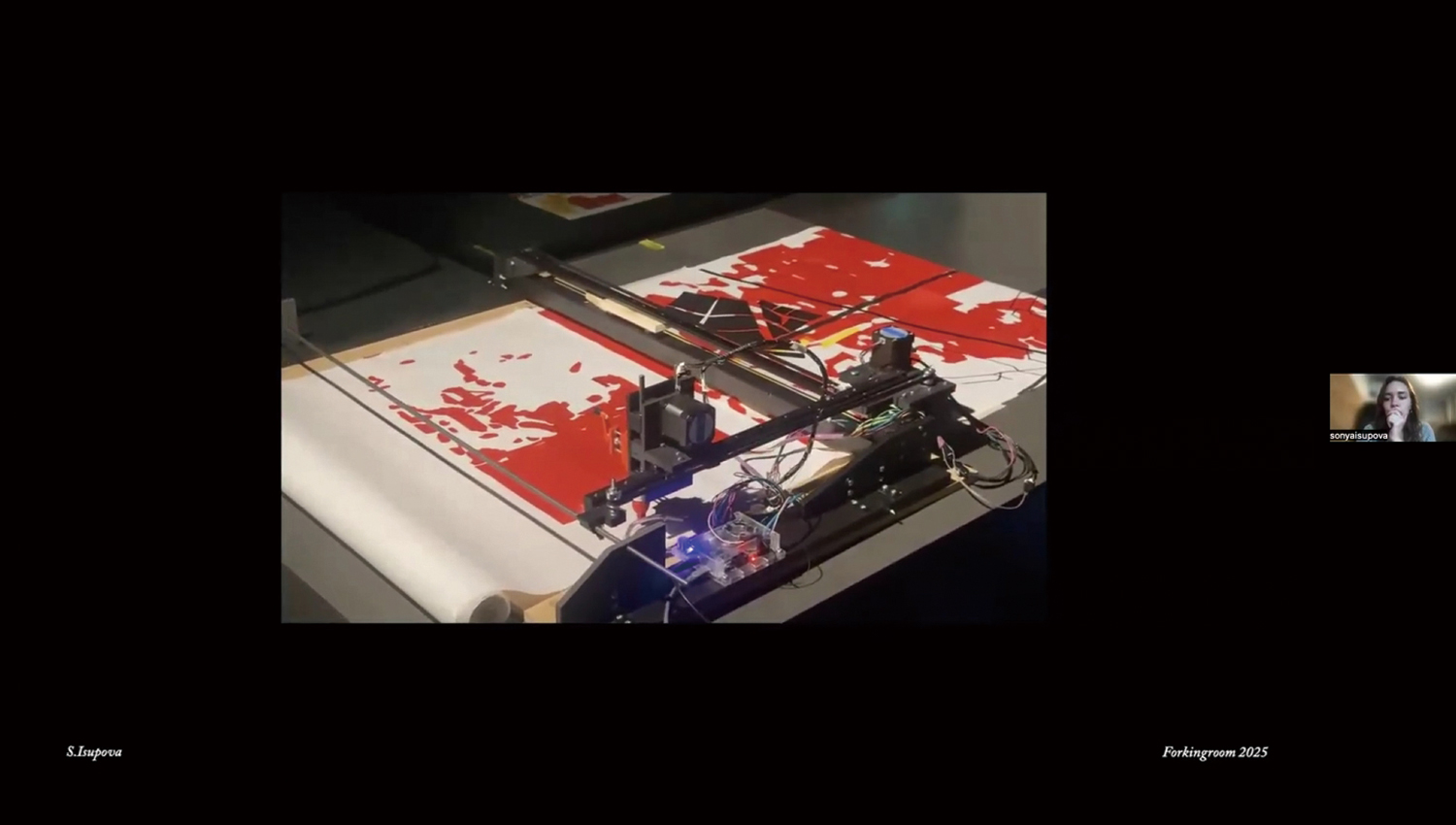
A robotic drawing machine in the process of creating a maps. Screenshot from Zoom
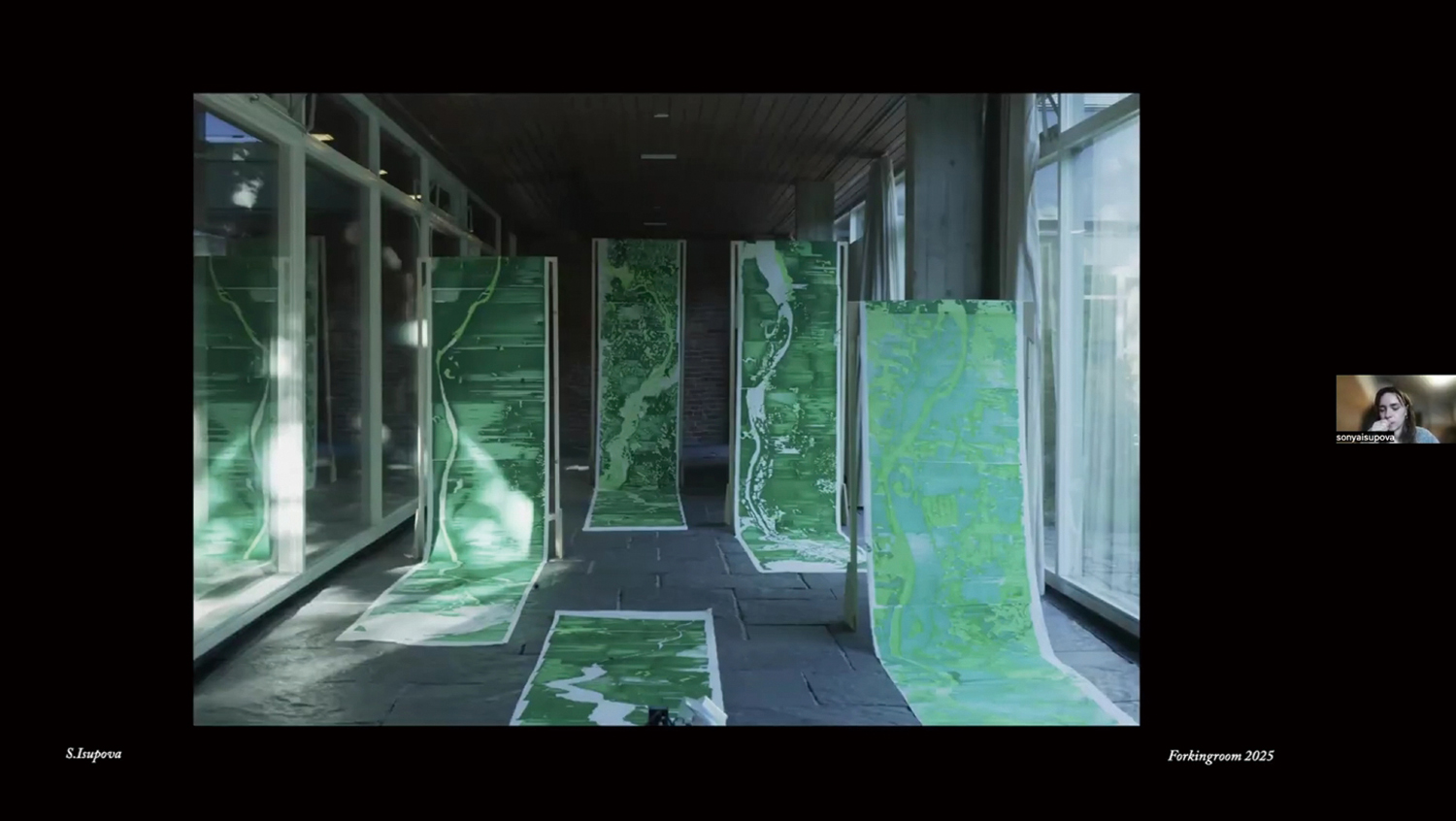
View of maps by Sonya Isupova. Screenshot from Zoom
On Apr. 20, ‘Revealing the Landscape’, the final talk in the ‘Forking Room 2025’ programme, was held via online (Zoom). Forking Room is both a project and a temporary platform for research, exhibitions, workshops, lectures, talks, focusing on phenomena at the interfaces between art, technology, and society. In this talk, ‘Revealing the Landscape’, Sonya Isupova, a Ukrainian visual artist and designer currently based in Geneva, introduced a new visual mapping project of the Ukrainian topography and landscape, assembled through collected satellite data and her analysis of vegetation.
Isupova noted that ‘ever since the Russian invasion of Ukraine, news media outlets, intelligence agencies, independent cartographers, and journalists around the world have obsessed with maps.’ She added that people rely on maps as simple and legible visual tools to explain and communicate the complex and devastating reality of war. However, she also pointed out that this reductionist approach often oversimplifies the essence of the subject and has limitations when revealing the true extent of war’s damage. The scars are complex and forever etched into the motherland.
To be more specific, she focused on the destruction of the Kakhovka Dam on the Dnieper River on June 6, 2023, a by-product of the invasion. The explosion of the dam caused a whole host of serious environmental disasters, including flooding of dozens of villages and washing of wreckage into the coast of Odesa on the Black Sea. The Ukrainian government defined this as an act of ecocide. Furthermore, the leakage of toxic substances remaining beneath the seafloor has caused damage to marine life, and explosive landmines, buried during the war, have washed up along the coastline poising a threat to public safety. As a result, residents have lost access to the beach and parts of their daily lives. Alongside this, as the Dnieper River is considered as an important water source for nearby nuclear power plants, concerns have been raised about further possible secondary damage, such as shortages in cooling water supply. Fortunately, it has been confirmed that there is no direct impact on these power plants. Nevertheless, residents have suffered from acute anxiety.
With satellite data, Isupova has traced the environmental impact of the dam’s destruction on Ukraine’s landscape. The data she used was generated by an engine called Sentinel Hub. This platform not only collects a variety of agricultural data, such as trees, lawns, fences, growth, plant recovery, and reproduction, but also visualises this data in the form of maps. With this outcome, Isupova and a Ukrainian geoscientist were able to compare maps before and after deconstruction. Five key dates played a significant role in tracking these changes: June 25, 1987 (37 years before), May 6, 2022 (a year before), June 5, 2023 (a day before), June 18, 2023 (a week after) and Apr. 4, 2024 (a year after). Based on the data analysis, robotic drawing machines were used to illustrate large-scale maps. Data extracted from satellite images was slowly made manifest over several hours on the large sheets of paper. Throughout this process, Isupova closely observed the progress, replaced ink, and witnessed the formation of each map. This is her own way of practicing continuous observation and care. Through this unique methodology of map-making, the environmental impact of war becomes visible once again. In her work, Isupova documents the zeitgeist, and highlights silenced spaces and memories, as well as traces of colonial infrastructure.